Репозиторий
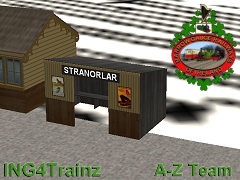
<kuid2:169585:28228:1> SF CDR Stranorlar platform shelter with sign
Platform shelter with renameable sign at Stranorlar station, County Donegal Railway (CDRJC). Stranorlar was the headquarters of the CDR. It began in 1853 as the terminus of the standard-gauge Finn Valley railway, but with the opening of the narrow-gauge West Donegal Railway through the Barnesmore Gap the FVR was regauged and Stranorlar became the HQ and main depot. The CDRJC system eventually had branches to Killybegs, Ballyshannon, Glenties, Letterkenny and Derry. The station was closed in 1960 and eventually all the buildings were demolished to make room for a bus park.
gnr(i) poster.texture.txt
36 B
dirty whitewashed wall 2.texture.txt
47 B
lms cunard poster.texture.txt
40 B
dirty whitewashed wall 2.tga
12.5 kB
wood base 2.texture.txt
34 B
wood base 3.texture.txt
34 B
shelter wall.tga
12.5 kB
stranorlar_platform_shelter_with_sign.im
12.9 kB
screenshot.jpg
40.8 kB
shelter wall.texture.txt
35 B
wood base 2.tga
24.5 kB
wood base 3.tga
24.5 kB
gnr(i) poster.tga
96.5 kB
lms cunard poster.tga
96.5 kB
Общий объём файлов:
321.1 kB
Версии элемента:
kuid
kind
name
build
date
size
<kuid2:169585:28228:1> scenery SF CDR Stranorlar platform shelter with sign 3.5 23.07.2020 21:11:25 233.6 kB
Зависимости:
kuid
author
kind
name
build
date
size
Нет
Зависимые элементы:
kuid
author
kind
name
build
date
size
<kuid:265816:103331> #265816 map Cambrian & LNWR Railways 4.5 6.09.2025 1:15:22 32.2 MB
<kuid:276055:100080> #276055 map Ireland 1920 3.7 21.09.2025 9:23:44 324.2 kB
<kuid:304444:100957> #304444 map Mold and Denbigh branchline, North Wales, UK: 1950s-1960s TANE 4.5 5.10.2025 2:12:45 7.6 MB
<kuid:304444:101096> #304444 map Mold and Denbigh branchline V2 , North Wales, UK: 1950s-1960s TANE 4.5 1.10.2025 5:55:11 7.7 MB
<kuid:304444:115627> #304444 map Dearnbyshire: UK Mainline, Branchline & Narrow Gauge 1950s - 1960s v1 5.2 12.09.2025 3:55:46 38.2 MB
<kuid:304444:117612> #304444 map Dearnbyshire v2: UK Mainline, Branchline & Narrow Gauge 1950s - 1960s 5.4 12.09.2025 3:45:59 39.6 MB
<kuid:1128457:100043> #1128457 map Mold and Denbigh branchline V2 [with ttte] 5.5 30.09.2025 18:55:00 7.8 MB
Powered by AKR © Камиль Ахметзянов aka kemal, 2011 - 2026
 Тип: scenery